CARTO Layer
CartoLayer renders cloud data from any connection (BigQuery, Snowflake, Redshift, Postgres, Databricks). It’s a wrapper over the CartoLayer in deck.gl.
Pydeck-carto is a package outside of pydeck, so calling pydeck_carto.register_carto_layer() is required to register CartoLayer in pydeck.
Example
import pydeck as pdk
from carto_auth import CartoAuth
from pydeck_carto import register_carto_layer, get_layer_credentials
from pydeck_carto.layer import MapType, CartoConnection
# Authentication with CARTO
carto_auth = CartoAuth.from_oauth()
# Register CartoLayer in pydeck
register_carto_layer()
# Render CartoLayer in pydeck
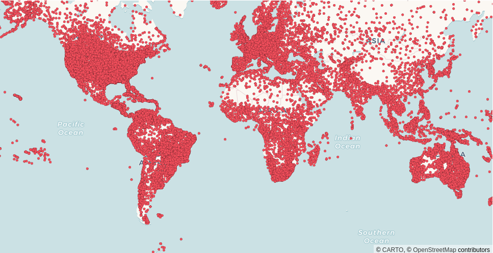
layer = pdk.Layer(
"CartoLayer",
data="carto-demo-data.demo_tables.world_airports",
type_=MapType.TABLE,
connection=CartoConnection.CARTO_DW,
credentials=get_layer_credentials(carto_auth),
get_fill_color=[238, 77, 90],
point_radius_min_pixels=2.5,
pickable=True,
)
map_style = pdk.map_styles.ROAD
view_state = pdk.ViewState(latitude=0, longitude=0, zoom=1)
tooltip={"html": "<b>Name:</b> {name}", "style": {"color": "white"}}
pdk.Deck(layer, map_style=map_style, initial_view_state=view_state, tooltip=tooltip)
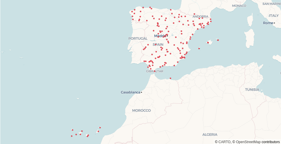
# Render CartoLayer in pydeck:
# - SQL query from a BigQuery connection
layer = pdk.Layer(
    "CartoLayer",
    data="""
        SELECT a.geom, a.name
        FROM `carto-demo-data.demo_tables.world_airports` AS a,
             `carto-do-public-data.natural_earth.geography_glo_admin0countries_410` AS g
        WHERE g.ADMIN = 'Spain' AND
              ST_INTERSECTS(a.geom, g.geom)
    """,
    type_=MapType.QUERY,
    connection=pdk.types.String("bigquery"),
    credentials=get_layer_credentials(carto_auth),
    get_fill_color=[238, 77, 90],
    point_radius_min_pixels=2.5,
    pickable=True,
)
map_style = pdk.map_styles.ROAD
view_state = pdk.ViewState(latitude=36, longitude=-7.44, zoom=4)
tooltip = {"html": "<b>Name:</b> {name}", "style": {"color": "white"}}
pdk.Deck(layer, map_style=map_style, initial_view_state=view_state, tooltip=tooltip)
Note that show() function is not supported with CARTO layers yet.
Error management
Any data error is displayed instead of the map to provide instant feedback about the input parameters. For example, the user is not authorized, the connection or the column names do not exist, etc.

Properties
data: (
str) Either a SQL query or a name of dataset/tileset.type_: (
pydeck.types.String) Type of the input data. It can be either QUERY, TABLE or TILESET.pydeck_carto.layer.MapType().connection: (
pydeck.types.String) Name of the connection registered in the CARTO Workspace. The connection for the CARTO Data Warehouse is already defined as a constantpydeck_carto.layer.CartoConnection().geo_column: (
pydeck.types.String, optional) Name of the geo_column in the CARTO platform. It also support spatial indexes (h3, quadbin)pydeck_carto.layer.GeoColumnType().credentials: (
dict) Defines the app credentials to gather the information from CARTO. It is recommended to usepydeck_carto.get_layer_credentials()to obtain automatically the token from Oauth using the carto-auth package.aggregation_exp: (
pydeck.types.String, optional) Aggregation SQL expression. Only used for spatial index datasets.aggregation_res_level: (
int, optional) Aggregation resolution level. Only used for spatial index datasets, defaults to 6 for quadbins, 4 for h3.
Check the full list of CartoLayer properties.
Reference
- get_layer_credentials(carto_auth) dict
Get the layer credentials object to gather information from carto warehouses.
The return object has the following structure:
{"apiVersion": "v3", "apiBaseUrl": "...", "accessToken": "...",}
- register_carto_layer()
Add CartoLayer JS bundle to pydeck’s custom libraries.
- class MapType
- QUERY
alias of query
- TABLE
alias of table
- TILESET
alias of tileset
- class CartoConnection
- CARTO_DW
alias of carto_dw
- class GeoColumnType
- H3
alias of h3
- QUADBIN
alias of quadbin